


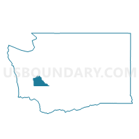
Bucoda Voting District, Thurston County, Washington
About
Outline

Summary
| Unique Area Identifier | 689718 |
| Name | Bucoda Voting District |
| County | Thurston County |
| State | Washington |
| Area (square miles) | 0.59 |
| Land Area (square miles) | 0.57 |
| Water Area (square miles) | 0.02 |
| % of Land Area | 96.75 |
| % of Water Area | 3.25 |
| Latitude of the Internal Point | 46.79656810 |
| Longtitude of the Internal Point | -122.86721290 |
Maps


Graphs
Select a template below for downloading or customizing gragh for Bucoda Voting District, Thurston County, Washington


Neighbors
Neighoring Voting District (by Name) Neighboring Voting District on the Map
- Gibson Valley Voting District, Thurston County, WA
- Scatter Creek Voting District, Thurston County, WA
- Skookumchuck Voting District, Thurston County, WA